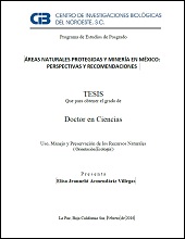
Áreas Naturales Protegidas y Minería en México: Perspectivas y Recomendaciones
Metadata
Show full item recordAbstract
México, presenta actualmente un resurgimiento minero sin precedentes en la historia de la minería en el país. A pesar de su fuerte tradición minera, la nueva forma de extracción, su escala, su contexto económico y legislativo, así como el modelo social que genera, son muy distintos a la minería del pasado. La nueva minería en México está dirigida principalmente a metales industriales y preciosos, esta actividad se realiza a gran escala y principalmente a cielo abierto. Produce impactos medioambientales tales como: contaminación de ríos y acuíferos con metales pesados y otras sustancias, drenaje ácido, remoción de la cubierta vegetal, generación de grandes cantidades de escombros contaminantes, abatimiento de fuentes de agua, emisiones continuas de gases y polvos a la atmósfera durante la extracción y procesamiento. El objetivo de este trabajo fue diagnosticar el estado actual y las perspectivas en el manejo de las Áreas Naturales Protegidas (ANP) federales en relación al traslapo con concesiones y proyectos mineros, en general para el país y con atención a aquellas ubicadas en la Península de Baja California, así como elaborar indicadores que permitan evaluar la cantidad de desechos potencialmente tóxicos de distintos proyectos mineros, y el grado de exposición de las ANP de acuerdo a su categoría de manejo. Para calcular el porcentaje de traslapo, número de concesiones y minerales a extraer en las ANP federales y considerando que un polígono representa el perímetro de un área natural protegida o de una concesión minera, se emplearon los polígonos georreferenciados actualizados al 2013 de la Comisión de Áreas Naturales Protegidas y los polígonos geo-referenciados de las concesiones mineras que otorga la Secretaría de Economía, por medio del Instituto Federal de Acceso a la Información (IFAI) con información hasta el 2010 y que es vigente a la fecha, así como los principales proyectos mineros georreferenciados por el Servicio Geológico Minero. Con Arc View GIS 3.1 se calculó la superficie de ANP traslapada con concesiones mineras. Para generar el Indicador compuesto de Generación de Residuos Potencialmente Tóxicos de Proyectos Mineros (IGRPT-PM), se seleccionó una serie de indicadores sobre las características y grado de procesamiento [...] Mexico currently has a mining resurgence unprecedented in the history of mining in the country. Despite its strong mining tradition, the new form of extraction, its scale, its economic and legislative context and the social model that generates, are very different from past mining. The new mining in Mexico is aimed primarily at industrial and precious metals, which makes large-scale, mainly in the open. Produce environmental impacts such as pollution of rivers and aquifers with heavy metals and other substances, acid mine drainage, removal of vegetation cover, generating large quantities of contaminating debris abatement of water sources, continuous emissions of gases and dust into the atmosphere during extraction and processing. The aim of this study is to diagnose the current state and perspectives in the management of federal protected areas in relation to overlapping concessions and mining projects in general for the country and with attention to the ANP located on the Peninsula Baja California, and develop indicators to assess the amount of potentially toxic waste from different mining projects, and the degree of exposure of ANP according to their management category. To calculate the percentage of overlap, number of concessions and minerals extracted in federal ANP and whereas a polygon represents the perimeter of a protected area or a mining concession, georeferenced polygons updated to 2013 Protected Natural Areas were used Commission of Natural Protected Areas and georeferenced polygons of mining concessions granted by the Ministry of Economy, through the Federal Institute of access to Public information (IFAI) with information until 2010 and that is in effect on the date, as well as major mining projects georeferenced by the Geological and mining to date. Arc View GIS 3.1 ANP surface overlapping mining concessions was calculated. To generate the composite indicator Potentially Toxic Waste Generation Mining Project (IGRPTPM), a series of indicators on the characteristics and degree of processing was selected [...]
Collections
Related items
Showing items related by title, author, creator and subject.